Showing posts with label Topo Survey. Show all posts

Saturday, 12 February 2011

Can't survey the wood for the trees - Surveys for Forestry Commission

3D landscape visualisation

Severn Partnership in conjunction with Parsons Brickerhoff in Cardiff have been selected for a framework contract with the Forestry Commission Wales.

Our surveyors will create 3D topographical surveys for use in in haul road design and cut & fill volume computations for subsequent earthworks.

We will be able to utilise the latest one man robotic total stations in conjunction with Leica's Smartnet RTK GPS to aid productivity and accuracy.

Contact Nick blenkarn or Bob Hutchings for any topographical survey requirements

Contact Us

Monday, 21 September 2009

Rock face laser scanning


Surveyors Rollo Rigby and Ash Johnson have just completed detailed laser scanning of a cliff face to enable Geotechnical investigations and design. The project will prevent rock fall and 3D laser scanning is the perfect technique for fast and accurate 3D mapping of irregular rock faces. Deliverables include snapshot image visualisations, 3D animated fly-throughs, standard topo contour plans, cross sections and the source point cloud data. The point cloud data can be viewed using a free viewer (pointools).


For more information, call Nick Blenkarn on 0844 880 8247 (webenquiry@severnpartnership.co.uk)

Topographical Survey - Aberystwyth University


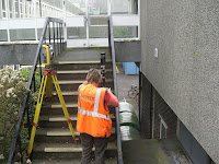
Robotic survey techniques have been used to speed up topographical surveying at Aberystwyth University. Surveyors were working 'one man' (or woman) with Trimble S6 and S8 total stations to produce accurate Topo survey plans.