Tuesday, 1 February 2011

Railway Track survey and GPS Control - A frosty start to 2011

Severn Partnership has had to come out “the blocks” at an electrifying pace in 2011 with over 70 miles of mainline railway already surveyed.

Railway surveyors on track in the snow

Railway Track surveys included:

  • St. Pancras to Sheffield  – Midland Mainline over 48 Miles of track surveyed making also making use of the GRP5000 kinematic laser scanning system wit the latest clearoute software from Amberg Technologies.
  • Walsall to Rugeley Trent Valley – RRN – 12 Miles of railway track including fence to boundary fence for the West Midlands Signalling Renewals.

Quality survey data is being delivered to the clients using Severn Partnership’s experienced railway surveyors who are all PTS qualified with Senior Surveyors being COSS qualified.

Large scale geodetic networks are observed using upto 16 number GPS units, simultaneously at times. This is backed up by bespoke Railgrid software experience in which has been gathered over the last 7 years and the commissioning of 9 Railgrid mapping projections including the MM07 Snakegrid for Midland Mainline in 2007.

The Rail Engineer article on St Pancras to Sheffield Geodetic control survey


Contact Us with to talk through your railway survey requirements

Wednesday, 22 September 2010

Environmental day at the races

A team building day at the races, with an environmental twist....Walk from office to the Bus -> Train to Chester and the reverse back.  With just enough time inbetween to support the Tote and enjoy the sunshine at Chester races.


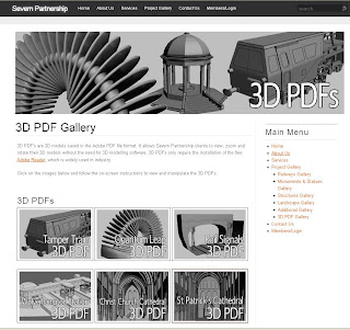
3D PDFs - 3D model issued as a PDF

http://www.3d-model.co.uk/3dpdfgallery/

Ever heard of a 3D PDF - we can now create them to issue our 3D modelling projects and enable viewing and 3D manipulation of the models without the need for specialist software.

They work with adobe reader, or can be access over the web by clicking on the main image to activate the 3D browser.

Have a go...

http://www.3d-model.co.uk/3dpdfgallery/

Monday, 6 September 2010

James Pike - best student award at TSA course


James Pike has worked with Severn Partnership for 5 years and recently completed The Survey Association “Introduction to Surveying Course” graduating on Friday 30th July, 2010, at the Survey School Worcester. It was a great day especially with James being presented the Best Student Award by Graham Mills President TSA. The work produced by the 26 students was of a very high standard according to the lecturers Andrew Crumpler and Frank Buckley who we would like to thank for helping James through the course.

Thanks also to Leica and TSA sponsoring the awards which meant James also walked away with 2 cheques – well done James - the rest of Severn Partnership are now looking forward to those drinks!

James has now been promoted from Surveyor in Training to Surveyor Grade 1 and has decided to work towards CICES technical grade membership.

Severn Partnership supports the World Scout Jamboree 2011.


“Please let me extend the thanks and gratitude of the entire Birmingham Jamboree Unit to Severn Partnership in response to your kind donation. With your assistance we’re making fantastic progress towards our fundraising total, which will enable 36 young people from the Birmingham area to enjoy a life changing opportunity at the World Scout Jamboree in Sweden in 2011” – John Nelson Scout Leader

Friday, 25 June 2010

RICS golf day for LionHeart


The 2010 RICS golf day in support of Lionheart was held at Mile End in Oswestry.  The Sun came out and 12 teams from around Shropshire had a great day - organised by Mark Combes from Severn Partnership and David Goff.  The winning team was from Nock Deighton, followed closely by Halls Auctioneers in second and Godfrey Temperton in third. The day was also supported by nb2bc, Andrew Mason Consultancy, SCCS, Mercian Developments, Jacobs, Wrekin Housing trust and Applications in CADD who supply our n4ce survey software.  


Friday, 18 June 2010

Introducing 3d-model.co.uk


Introducing  3D-Model.co.uk home to Severn Partnership's 3D modelling and visualisation department, specialising in creating 3D models, images and videos from 3D Laser Scanned Point Clouds.

Utilising Laser Scan Data for faster, more accurate 3D Models.

Wednesday, 9 June 2010

Flickr photostream - images and videos

A selection of images, screenshots animations and photos of our surveyors working around the UK near boats, planes, trains and automobiles.

Follow the link to our photo stream... Flickr photostream

Monday, 7 June 2010

3D model visualisation - Quarry

An animation fly-through of our texture mapped 3D modelling of a slate quarry. The original survey was completed using aerial photogrammetry and the 3D model was rendered in 3DSMax.

Thursday, 27 May 2010

3D modelling - Tamper train


From scan cloud to 3D model, this tamper train illustrates the process.  This is only half the storey as the next step is toanimate the moving parts of the tamper and re-create the movement of ballast using physics engines to control actions !

Heritage 3D modelling - New and Old

 
Heritage to be (Quantum Leap in Shrewsbury), and two more examples of dimensionally accurate modelling from 3D point clouds.  The founding fathers of Birmingham and the Lord Hill column.  Both examples of 3D modelling from high detail 3D laser scanning point clouds.  Once modelled, digital photographs can be texture mapped on to give the realistic visualisations.

SPAR 2010 - Houston Laser scanning Conference

In February, Nick Blenkarn and 3D modeller Mark King made they journey over to Houston for the 2010 SPAR Laser scanning conference.

Keeping up to date on the latest scanning software & hardware, with time for a quick trip to the Houston Aeros and the Johnson Space Centre...

SPAR 2010 website