Showing posts with label 3D navigation systems. Show all posts

Thursday, 11 August 2011

The Shipping Forecast

Jan Steen, 3D Model for Navigation Software
More ships have been added to our fleet of Nautical 3D models. The Jan Steen is a vessel owned by Global Marine Systems (GMS) and is going to be used on the London Offshore Wind Array.

The high accuracy 3D model was created from 3D Laser Scan data collected while the vessel was in dry dock in Rotterdam and Middlesbrough. It was created using Rhino3D and Autodesk 3DS Max and will be used in GMS's onboard 3D navigation system.

Click here for more information regarding our Shipping & Marine Services
Or call Mark King (3D Modelling & Visulaisation) on 0844 880 8247
 
Jan Steen, Rhino3D Model
High Accuracy Ship 3D Model

Tuesday, 24 May 2011

It's Art if we say it is !!!

Cable Laying ship in dry dock

Land Surveys as modern art - perhaps not the Turner prize this year, but when we combine fined registered scan cloud data with site images the results are quite colourful !

We have the ship in dry dock - 3D laser scanning to create a 3D model of the ship hull - completed in one day on site. The point cloud is coloured  with reference to height.

The founding Fathers of Birmingham


Next is a statue of the Founding Fathers of Birmingham for insurance records and to enable repairs based on measurement and accurate records should they be required.


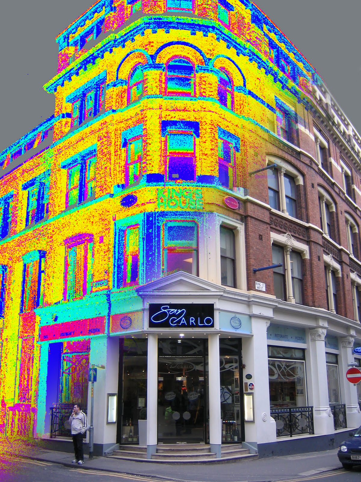
Architectural laser scanning


This Facade elevation in Manchester was for heritage planning approval ready for internal remodelling of the building. Deliverables were 2D elevations and plan
sections.


Barr Beacon Heritage laser scanning


Barr Beacon was surveyed for an Architectural consultancy, requiring topographical survey, cross sections and elevations. Scanning for historical archive of monuments can also cover against potential future damage.....


For more information, call Nick Blenkarn at he Severn Partnership on 0844 880 8247 or email webenquiry@severnpartnership.co.uk


Tuesday, 22 February 2011

Scanning & Modelling the Severn Seas...

3D Model of CS Sovereign
Severn Partnership has been laser scanning cable laying ships around the world for Global Marine Systems (GMS). This included GMS's flagship the 'CS Sovereign' as well as the world’s largest cable laying ship; the ‘Cable Innovator’ which was based in Hong Kong at the time.
 
The completed point cloud was then used to create 3D models for integration within GMS’s new 3D navigation system. These models were textured using a single image to give them a more realistic look, similar to the techniques used in the Game Industry (see above image). 

Or call Mark King (3D Modelling & Visualisation) on 0844 880 8247